

Adjusted master plan of Da Nang city to 2030 with a vision to 2045
Monday, May 31,2021
AsemconnectVietnam - To be an important transport and telecommunications hub in the region, nationally and internationally
Adjusted master plan of Da Nang city to 2030 with a vision to 2045\
1. Scope, boundaries and time limit for making plan
a) Scope, boundaries
- The plan scope covers the entire administrative boundary of Da Nang city with a total area of about 129,046 hectares. In which: the land area is about 98,546 ha, the area of Hoang Sa district is 30,500 ha. The boundaries are as follows:
+ To the north, it borders Thua Thien Hue province;
+ The West and South borders Quang Nam province;
+ The East borders the East Sea.
b) Time limit for planning: By 2030, with a vision to 2045.
2. Urban properties and functions
- Being a grade I city directly under the central government, a major national economic center for tourism, industry, commerce, financial and banking services, has an important position in the national urban development strategy. .
- Being the center of culture, physical training, sport, education and training, the center of science, technology and technology of the Central region and the Central Highlands.
- To be an important transport and telecommunications hub in the region, nationally and internationally.
- As one of the areas holding an important strategic position in terms of national defense and security in the South Central region, the Central Highlands and the whole country.
3. Development goals and vision
a) Development goals
- To build Da Nang city into one of the major socio-economic centers of the country and Southeast Asia, with the role of a center for entrepreneurship, innovation, tourism and commerce, finance, logistics, high-tech industry, information technology, supporting industry.
- Being one of the centers of culture - sport, education - training, high quality healthcare, science - technology development of the country.
- Center for organizing regional and international events.
- A seaport city, an international coastal city with the position as the nucleus of the urban chain and the growth pole of the key economic region of the Central - Central Highlands.
- To become an ecological, modern and smart city, a livable city; national defense, security and sovereignty of the sea and islands are firmly guaranteed.
b) Vision to 2045: To become a big city; smart, creative; identity, sustainability.
4. Population size, urban land
a) Population
- Population forecast by 2030 is about 1.79 million people (including permanent and temporary residents and converted tourists); in which the permanent and temporary resident population is forecasted to be about 1.56 million people.
- Population forecast by 2045 is about 2.56 million people (including permanent and temporary residents and converted tourists); in which the permanent and temporary resident population is forecasted to be about 2.13 million people.
b) Scale of urban construction land
- The area of urban construction land by 2030 will be about 31,836 ha, accounting for about 32.31% of the land area on the mainland.
- The area of land for urban construction by 2045 is about 35,054 ha, accounting for about 35.57% of the land area on the mainland.
5. Land use planning
The total area is about 129,046 hectares. Orientations for land use planning to 2030 are as follows:
a) Land for urban construction by 2030 is about 31,836 ha, accounting for about 32.31% of land area, of which:
- Civil land, about 14,109 ha (about 90.4 m2/person), accounting for about 44.32% of urban construction land, of which:
+ Land for residential units, about 9,591 ha (about 61.5 m2/person), including: Groups of houses; service - public works; public greenery; roads and car parks for residential units. In which, the unit land is about 7,180 ha, the residential land combined with trade and service is about 2,411 ha;
+ Urban-level public-service land, about 456 ha, including land for construction of commercial, service, market, cultural institutions, ... urban level;
+ High school land, about 108 ha;
+ Urban green land for public use, about 1,394 ha;
+ Land for mixed use, about 2,560 ha, including land for construction of houses and mixed works or used for a number of different purposes such as: Groups of houses combined with trade, services, tourism; service - public works; public greenery; roads and parking lots.
- Non-residential land is about 17,727 ha, including; Industrial and high-tech land is about 4,119 ha; warehouse land (warehouse and logistics center) about 229 ha; land for research and training center is about 569 ha; agency land is about 43 ha; medical center land is about 137 ha; tourist land is about 2,388 ha; religious land, relics about 109 ha; about 3,085 ha of traffic land (taking into account inter-regional roads, excluding static traffic); land for key technical infrastructure works is about 1,140 ha; thematic green land is about 429 ha; about 931 ha of fitness center land; dedicated green land about 1,476 ha; land for security and defense is about 2,392 ha (excluding Hoang Sa district); cemetery land is about 680 hectares.
b) Other land: About 66,710 ha, including: Land in villages about 2,492 ha; Agricultural land is about 4,619 ha; special-use forest land is about 31,081 ha, protection forest land is about 8,938 ha, production forest land is about 16,315 ha, water surface is about 3,221 ha; reserve land is about 104 ha.
c) Hoang Sa district: 30,500 ha.
6. Model and structure of spatial development
a) Urban structure
- The urban structure is associated with the typical landscape according to 03 urban areas, including the waterside area, the green core area, the hillside area and 01 ecological zone, including the forest, mountain and hill areas to the west and north , Son Tra national tourist area and Hoang Sa district, rivers and lakes along with coastlines in eco-regions.
- Forming 02 economic belts: (1) Northern Belt - High-tech Industrial Belt and Seaport - Logistics; (2) Southern Belt - Innovation Belt and High-tech Agriculture.
- Adjusting the structure of a single-center urban area (Thanh Khe and Hai Chau) into a multi-polar development, adding 04 priority clusters of jobs including; (1) High-tech Industrial Cluster; (2) Seaport and Logistics Cluster; (3) High-tech Agricultural Cluster; (4) Innovation Cluster.
- To develop tourism throughout the city with a focus on the East Coast (coastal of Son Tra - Ngu Hanh Son) and Da Nang bay with natural water surface features, cultural heritage and waterway tourism services; eco-tourism in the western and northern mountainous areas and Son Tra peninsula to take advantage of the natural landscape and biodiversity.
b) Development model
- Development of distributed centers, including: (1) Urban centers associated with the City Center; (2) High-tech Service Center in the Northwest of the City; (3) Trade and service center associated with the new railway station; (4) Innovation Center in the South of the City.
- To form urban areas, each with a population of about 50,000 to 250,000 people; organize urban areas into residential units with a population of between 18,000 and 20,000 people on the basis of being organized from groups of houses from 1,400 to 2,100 people; basically meet the system of service establishments, social welfare works, grassroots cultural institutions according to each level, in accordance with the standards, cultural characteristics and needs of the people.
7. Orientation for spatial organization
a) Overall spatial development orientation
- Existing urban areas: Re-develop existing urban areas according to the compact urban model, improve the land use coefficient, add urban utilities and integrate with the public transport system. Controlling the coastal corridor connecting individual projects into a general whole, giving priority to the development of spaces, works and services to serve the community; take measures to respond to climate change and sea level rise.
- New development areas: To expand and develop new urban areas, to form areas with specialized functions; changing structure, spatial morphology, population distribution and new urban model including development of high-rise areas. Exploit hilly areas to enhance and supplement green space, develop tourism services in harmony with landscape spatial morphology and topography. Existing industrial parks and hi-tech parks are renovated, upgraded and expanded; new industrial parks are built with complete structure; develop large-scale concentrated trade and service centers.
- Orientation for urban development of Hoa Vang district's town, is the administrative center of the district, the gateway connecting the Northwest districts of Quang Nam province and the Central Highlands provinces; is a multi-sector economic sub-center, prioritizing the development of trade and supporting services for high-tech agricultural areas. The size of the land area is about 200 ha, the population is about 36,000 people (the target of land unit is 50 m2/person - grade V urban area). Develop synchronous technical and social infrastructure according to urban standards.
- Rural areas: Reorganize the space and functional structure of areas in the process of urbanization asymptotically according to urban standards in association with preserving the traditional architectural identity; by 2030, the communes of Hoa Vang district will develop to meet the urban standard of grade V. Create reserve areas for development for the periods after 2030, after 2045. Rural areas will be concentrated in Hoa Vang district, including rural residential areas, renovated and embellished traditional craft villages, garden houses associated with high-tech agricultural production areas in combination with eco-tourism, community, conservation nature reserves, existing agricultural and forestry production areas.
- Conserve and promote biodiversity, terrain, natural green space, develop a system of parks, trees and water surface to create a typical image of the City.
b) Orientation for spatial development according to subdivisions
- The whole city is organized into 12 subdivisions, in which:
(1) Subdivision along the Han River and the East Coast: The area is about 6,644 hectares, the population is expected to be about 484,000 people.
(2) Da Nang Bayside Subdivision: Area is about 1,530 ha. The population is expected to be about 192,000 people.
(3) Lien Chieu Seaport Subdivision: The area is about 1,285 ha. The population is expected to be about 19,000 people.
(4) High-tech sub-zone: Area is about 5,585 ha. The population is expected to be about 314,000 people.
(5) Green Core Center Subdivision: Area is about 4,775 ha. The population is expected to be about 61,000 people.
(6) Innovation subdivision: The area is about 3,903 ha. The population is expected to be about 233,000 people.
(7) Airport Subdivision: Area is about 1,327 ha. The population is expected to be about 104,000 people.
(8) Urban subdivision Hillside: The area is about 2,729 ha. The population is expected to be about 270,000 people.
(9) High-tech Agriculture Subdivision: The area is about 2,986 hectares. The population is expected to be about 27,000 people.
(10) Development Reserve Subdivision: Area is about 5,858 ha. The population is expected to be about 62,000 people.
(11) Western ecological subdivision: Area is about 57,692 ha. The population is expected to be about 21,000 people.
(12) Eastern ecological subdivision: Including Hoang Sa district with an area of 30,500 ha and Son Tra peninsula with an area of about 4,232 ha. The population is expected to be about 7,000 people.
8. Orientation for development of economic and social infrastructure system
a) Administrative centers, agencies
The system of administrative centers and agencies includes important political and administrative functions such as Party, government and other agencies, with a land area of about 43 hectares.
The city's administrative center is in Hai Chau district, with a land area of about 1.1 ha; supplementing other administrative functions, a number of departments, divisions and branches are dispersed across regions.
Continue to renovate and upgrade the system of administrative centers and agencies at district and district levels with a land area of about 27 hectares, of which the People's Committee of Hoang Sa district is a specific administrative unit, carrying out activities to fight, protect and affirm Vietnam's sovereignty over the Hoang Sa archipelago.
b) Tourism
To develop tourism throughout the city in association with forms of sea tourism; inland waterway tourism; eco-tourism, community; cultural, historical and spiritual tourism; urban tourism; tourism, general entertainment, shopping; sports tourism; healthcare tourism; The land area is about 2,388 ha.
Focus on investing and completing key projects, including: Complex of financial, commercial, service and entertainment centers; Park of Culture and Amusement Southeast of the Monument; VinaCapital Danang golf course; Complex of works serving Danang International Fireworks Festival; Thematic Park in the South of Son Tra Peninsula; Ba Na - Suoi Mo eco-tourism complex, Ba Na Hills tourist area; Lang Van integrated tourist resort; InterContinental Danang Sun Peninsula Resort.
c) Trade, finance
- Forming national and international trade centers; forming commercial and financial streets; establishment of a male non-tariff zone in an urban, commercial, and non-tariff complex.
- Maintain the existing supermarket system, put into operation duty-free shops in the street.
- Maintaining traditional markets, promoting the value of traditional civilized markets, Han and Con markets in association with the Hung Vuong trade axis; invest in new Hoa Phuoc wholesale market, convert Hoa Cuong wholesale market into a grade 1 general population market.
d) High technology
To focus on developing high technology with a land area of about 1,710 ha, including: (1) Da Nang Hi-tech Park and Expanded Hi-Tech Park; (2) Centralized Information Technology Park No. 1, No. 2, No. 1, No. 2, No. 3 Software Park; (3) In addition, forming an Innovation Cluster in the South of the City associated with the Danang University Urban Area, Innovation Center and Software Park.
e) Industry and warehouses (warehouses and logistics centers)
- Focus on developing logistics centers and warehouses with a land area of about 229 hectares, including: Lien Chieu port logistics center, new Kim Lien station logistics center, Hi-tech Park logistics center and logistics center of Hoa Nhon, Da Nang International Airport Logistics Center, other retail logistics centers and warehouses.
- Invest in the development of industrial parks with a land area of about 2,326 ha, including: Hoa Cam Industrial Park phase 1, Lien Chieu; upgrading Hoa Khanh Industrial Park, expanding Hoa Khanh into an ecological industrial park; Da Nang Fisheries Service Industrial Park; forming new industrial parks: Hoa Cam phase 2, Hoa Nhon, Hoa Ninh and Hi-tech supporting industrial park.
- Forming new industrial clusters: Cam Le, Hoa Nhon, Hoa Khanh Nam, Hoa Hiep Bac with a land area of about 83 hectares.
- Maintain and develop the traditional craft village of Non Nuoc fine art sculpture - Ngu Hanh Son; forming Hoa Son split stone craft village.
f) Agriculture, forestry, fishery
- The scale of agricultural land is about 4,619 ha. Forming a hi-tech agricultural zone and area located in the southwest of the city, which functions as a center for research, testing, training, demonstration, transfer of high-tech applications and commodity production in agriculture in association with the development of areas of organic and specialized agricultural production, ecology combined with tourism. Areas with complex terrain mixed together, in the process of implementation, can consider converting to production forest land.
- Forestry: The scale of forestry land is about 56,334 ha, mainly concentrated in the western mountainous area and Son Tra peninsula, in which, special-use forest land is about 31,081 ha, protection forest land is about 8,938 ha , production forest land is about 16,315 ha. Forestry development orientation focuses on conserving special-use forests and protection forests, applying technology in afforestation of production forests, continuing to green hills, and mining areas in order to improve the quality forest cover, biodiversity, environmental restoration, landscape, ecological conservation and protection, climate change response. Areas of production forests with favorable conditions, especially areas along river routes, can be converted to agricultural land during the implementation process.
- Fisheries: The marine, river and lake environment will be maintained to ensure the regeneration and development of aquatic resources. Investing in upgrading fishing ports, developing fisheries logistics services, exploiting offshore seafood in association with protecting the sovereignty of sea and islands, applying high technology and modernizing the fishing industry to improve production efficiency and environmentally friendly, protecting aquatic resources.
g) Medical
The land area is about 137 hectares. Invest in upgrading, renovating and expanding general and specialized hospitals at city and district level to serve the needs of residents and visitors. Forming an international hospital in the Innovation subdivision to link with medical universities in the region.
Each urban area will have at least one polyclinic (medical center and health care center).
h) Education - Training
Expansion of existing universities, colleges, research and training centers, concentrated in the south of the city, especially Da Nang University Village to form a new University Urban Area. To form a number of new training and vocational institutions and specialized research institutes in the Hi-Tech subdivision. The land area of the research and training center is about 569 hectares.
The distribution of upper secondary schools is suitable for the population size of each subdivision and is located near the centers of urban areas, with a land area of about 108 hectares.
Other educational institutions are planned and distributed to ensure proper standards and meet the increasing demands of society.
i) Culture
Cultural institutions are distributed in the City and the urban center. Maintain, renovate and upgrade existing institutions such as libraries, theatres, cinemas and performance centers... New investment in city-level cultural institutions including vertical marine parks Danang Bay and East Coast, City Opera House, City Cultural Center, City Center Square, Ngu Hanh Son Cultural and Spiritual Park,... to serve residents and visitors.
Preserve important religious works and historical relics, including: Museum of Cham Sculpture, Da Nang Museum... religious and spiritual places (Linh Ung pagoda, Cathedral church, An Thuong Parish church, Cao Dai universal do...); historical sites (Dien Hai Citadel, Hai Van Quan, Hoa Vang cemetery...). The area of religious land and relics is about 109 hectares.
k) Gymnastics - Sports
The land area is about 931 hectares. Continue to invest and exploit Hoa Xuan Sports Complex, Tien Son Sports Village, Tien Son Sports Palace, golf courses (Ba Na, VinaCapital, along Ba Na - Suoi Mo, Hoa Phong - Hoa Phu routes), district-level sports centers...
l) Green park, water surface
Urban green land for public use is urban park land, green corridors along the riverbank area to ensure people's access, the land area is about 456 ha. Invest in renovating and upgrading existing parks, investing in new parks in urban areas. Specialized green land including nurseries, green tree land isolated from infrastructure, high voltage power lines, industrial parks, railways and main road traffic routes, the land area is about 1,476 ha. Land for green trees is limited to use in theme parks, with a land area of about 429 hectares.
Combining the rich green space of forests and mountains to contribute to improving the landscape value and protecting the environment.
The scale of the water surface area is about 3,221 ha, including ponds, lakes, rivers and streams (excluding the sea surface, which also contributes to the landscape value of the city).
Forming green corridors to connect landscape axes, open spaces, urban axes and other landscape elements including coastal areas, hills in the center of green core, Airport Danang International and residential areas, mixed-use areas.
9. Urban design.
a) Overall urban design framework.
- Protecting the value and exploiting the advantages of unique natural terrain conditions (peninsula, hills, rivers, streams, ponds and coastal sandy strips,...), preserving biodiversity. Maintain green spaces, views and views to natural landscaped areas.
- Preserve and promote the city's cultural and heritage values in order to preserve and develop the unique identity of the city.
- Encourage the exploitation of modern architectural styles, green architecture, buildings with appropriate construction density and form according to the identity and characteristics of each subdivision. The harmonious design ensures the cohesion between the natural landscape, buildings and urban activities.
- Enhance the connection of landscape space with "green" transport solutions, develop walking and bicycle forms, and reduce travel by personal motor vehicles. Landscape architecture organization focuses on a high percentage of green land, forming green patches, riverside lawns, isolated green areas between residential areas and industrial zones, a system of green corridors connecting cities and towns.
b) Space organization
- Urban gateway has 09 main locations, including: 03 northern gateways, 04 southern gateways, 02 western gateways. In addition, there are gateways at traffic hubs such as intercity bus stations, railway stations, and airports.
- Axes of space, landscape, open space:
+ The main urban axes in the North - South direction along the East Bank and on both sides of the Han River; in the East-West direction, including along Da Nang Bay, the West Ring Road.
+ Landscape axes: These are the main green corridors of the City, including walking paths along Da Nang Bay, the East Coast and the two banks of rivers such as Han River, Cu De River...
+ Squares: Upgrading and renovating existing squares; develop new squares associated with parks, lakes, administrative centers and commercial centers (CBD). In particular, the Central Square is proposed to be expanded into an area between the Han River, the Administrative Center and the Dien Hai Citadel.
- Forming the City Center Area to build the image of Da Nang urban center into a destination combining modernity and current cultural and historical sites preserved and integrated with other areas of urban development, new public spaces and easily accessible transport networks.
- Urban highlights: Living Museum Area, Commercial Business Center (CBD). Other urban highlights are specified in the zoning plan.
c) Organization of a green space network
- Organization of green spaces:
+ Green land for public use at urban level is organized: Green corridor includes corridors located along rivers such as Cu De and Han rivers. A linear park system along riverbanks and coastal areas, around lakes, at the intersection of green corridors and water surface, or near the center of each urban area;
- The isolated green corridor is formed into axes connecting green spaces throughout the City;
+ Theme parks are distributed to the downtown area, the East Coast and the West of the City, serving attractive entertainment activities for residents and visitors;
+ Environmentally sensitive areas: Conservation of special-use forests and protection forests: Including Bach Ma mountain range, Ba Na range and Son Tra peninsula. At the same time, these areas also have the potential to form an entertainment area such as a natural park and provide resort services. The central hills of Da Nang (Phuoc Tuong - An Ngai, the neighboring area to the east of Ba Na tourist area) are maintained and developed as the natural green space of the City.
- Organization of water surface space:
The area of the coastal sand strip of Da Nang organizes parks and walkways, ensuring the coastal protection corridor and the access of people and visitors.
Rivers in Da Nang include: Yen River, Cu De River, Han River, Co Co River, Cam Le River, Vinh Dien River,... green corridor, linear park.
Lakes and reservoirs include existing lakes such as Dong Nghe lake, Hoa Trung lake, Hoc Khe lake, Truc Dong lake, etc. as well as new reservoirs organized in low-lying areas west of Da Nang and the plains.
Planning for new urban areas, giving priority to reserve land fund to organize regulation lakes and flood drainage corridors; low-lying areas, frequently affected by floods, prioritize the application of flood-adaptive urban models, using the land fund to create temporary water storage areas, etc.
d) Development control indicators
- The average land use coefficient is from 1.0 to more than 7.0 times. In which: The existing downtown area is about 3.5 times and the area expanded to form a new financial city and the Central Business District (CBD) of Da Nang is about 7.0 times; In the suburbs of Da Nang, the land use coefficient is lower than 1.0 times. Particularly, the land use coefficient of the highlight works shall comply with the national technical regulations on construction planning.
- Average building height:
+ High-rise development areas with an average of more than 80 m are allowed in the expanded city center (part of Son Tra district and Ngu Hanh Son district);
+ Other high-rise development areas with an average of 60 m to 80 m are allowed in the current downtown area (part of Hai Chau district);
+ Medium-range development areas from 40 m to 60 m are concentrated mainly along Da Nang Bay (parts of Hai Chau, Thanh Khe, Lien Chieu districts) to ensure an unrestricted view of the Bay and the area around Da Nang airport;
+ Low-rise areas on average less than 40m are located in the take-off and landing corridor of the airport due to the limitation of airport static. Factories in the industrial zone have an average height of about 30m, and the average height of individual houses in the South is about 20m.
- Construction density: To maintain the current urban structure of Da Nang, existing urban areas need to comply with the requirements on construction density according to the national technical regulations on construction planning.
10. Orientation of technical infrastructure system planning
The scale of land for technical infrastructure works is about 1,140 ha, traffic land is about 3,085 ha (according to inter-regional roads, excluding static traffic), cemetery land is about 680 ha.
a) Traffic
- Outbound traffic:
+ Aviation: Continue to upgrade and expand Da Nang International Airport to reach a capacity of 30 million passengers per year, grade 4E, is an international gateway airport, the estimated land area is about 856 ha . To develop and expand synchronously service provision works at the airport according to the planning to become a dedicated logistics center;
+ Railway: Planning the route corridor for high-speed railway and national railway running parallel to the east of the expressway; build a new railway station with a capacity of 10 million passengers/year, with an area of about 30 hectares, a Depot with an area of about 60 hectares, in the northern area of the intersection between Ba Na - Suoi Mo road and the highway, associated with the formation of a system of trade and service centers, which is the driving force for the development of the western area of the city. Building a cargo terminal in Kim Lien area to connect with Lien Chieu port;
+ Seaport: To invest in building a new Lien Chieu port with a capacity of 50 million tons/year, an area of about 450 hectares (including the water surface); port logistics area is about 195 ha. Tien Sa port will be gradually transformed into a tourist port after Lien Chieu port comes into operation. Continue to develop Tho Quang Wharf as a general port for ships from 10,000 to 20,000 tons, with a specialized wharf for ships from 5,000 to 10,000 tons;
+ Road: Continue to build and upgrade National Highway 14B, the section from Tuy Loan to Ha Nha bridge (Dai Loc district, Quang Nam province), the section through Da Nang is about 8 km long, reaching the size of the main urban road of 6 lanes. Upgrading National Highway 14G from Hoa Vang district to Tay Giang (Quang Nam), the section through Da Nang is about 23 km long, reaching the design scale of a plain grade III road. Organizing traffic junctions connecting to the domestic traffic system;
+ Waterways: To develop waterways: Han river - Co Co river - Thu Bon river, Han river - Vinh Dien river - Thu Bon river; route from Da Nang Bay to Hon Son Tra Con, Cu Lao Cham to connect the city center with Hoi An for tourism development. To develop Han River port into a port to welcome large-sized cruise ships, to make the most of the advantages of waterway ports in the city center area, to promote the development of inland waterway tourism and international sea routes.
- Internal traffic:
+ Railways: Planning to develop branch railways connecting from cargo stations to industrial parks, logistics centers, inland ports;
+ Road:
Extending the Western Ring Road through the Hi-Tech Park, connecting at the intersection of La Son - Tuy Loan highway and the South bypass of Hai Van tunnel.
Additional planning of the route between the Western Ring Road and the expressway connecting Nguyen Tat Thanh Street (extended) through National Highway 14B near the administrative center of Hoa Vang district and extending to the sea. Extending the West Ring Road 2 to the Southern Ring Road.
Planning and construction of tunnels through the airport, connecting the East and the West; added new routes connecting directly from Lien Chieu port to the South bypass of Hai Van - Tuy Loan tunnel, from Nguyen Sinh Sac street to Hoang Van Thai extension, from Hoa Khanh Industrial Park to the new railway station to form the main axis connecting East - West.
In the city center area, the planning of Le Duan route connecting with Dong Da street creates a connecting axis from Dien Bien Phu street to 3 Thang 2 street; planning Hoang Hoa Tham route to Nguyen Tat Thanh street (through the existing railway station area) to form the main connecting axis from Nguyen Huu Tho - Le Dinh Ly - Hoang Hoa Tham - Nguyen Tat Thanh in order to reduce load for neighboring routes.
Planning and construction of tunnels across the river connecting from Dong Da - Tran Phu streets to Van Don - Tran Hung Dao streets; Road bridge connecting March 29, Cam Le district with Bui Ta Han street, Ngu Hanh Son district,...
+ Public transport system:
Planning 02 MRT lines, 11 LRT lines, 02 Tramway lines with appropriate Depot and transit points. Continue to develop the inner city bus network to ensure the necessary coverage and service radius; convenient connection and collection service for MRT, LRT, Tramway lines.
+ Key works (Bus station):
New planning of Northern inter-provincial bus station at Thanh Vinh industrial cluster (about 43 ha); Western bus station (gateway to the Central Highlands) in the area of Hoa Khuong Cement Factory (after relocation, the area is about 13 ha); continue to develop the southern bus station; orientation to convert the central bus station serving public transport; develop the area of the existing railway station after being relocated into a central public transport station in combination with the development of commercial services and parks.
+ Static traffic:
Develop a network of public parking stations, parking lots and spots to ensure that the land area for static traffic reaches (3÷4) % of the urban construction land area, of which the total area of the central parking lots center is about 120 ha. Encourage exploitation of underground space for parking in combination with urban public services.
+ Waterway: To develop waterways through Han river, Tuy Loan river, Yen river, Cu De river, Co Co river, around Son Tra peninsula...; planning and construction of inland waterways for tourism development.
b) Technical preparation
- Ground elevation and disaster prevention:
The control ground elevation calculated according to the calculated water level for residential areas, industrial zones - warehouses and central areas is P=1%.
The controlled background height calculated according to the calculated water level for isolated green areas and sports facilities is P=10%.
Control base elevation considering sea level rise under climate change scenario: +0.25m.
For old urban areas such as Hai Chau, Thanh Khe and new urban areas that have been built: Retain the current elevation, step by step study solutions to improve the current embankment levels in the urban areas. necessary areas along the Han River, Co Co, Cam Le, Cu De, Vinh Dien, etc. up to the controlled water level in combination with the solution of arranging pumping stations and regulating reservoirs.
For residential areas retaining embellishment and new urban planning areas in Hoa Vang district: To arrange dikes in necessary areas along Tuy Loan, Yen, Cu De, Vinh Dien river routes, etc. In the area in the dyke, the foundation is built at least P=5% and basically according to the current topography corresponding to the frequency P=(1÷5) %, combining the solution of arranging pumping station and regulating reservoir.
Strengthen the consolidation and upgrade of irrigation works, dikes and embankments to ensure safety against natural disasters and improve management efficiency. Upgrading system of sea embankment and large river mouth in necessary areas such as embankment along Da Nang bay, sea embankment of Da Phuoc urban area, Nam O embankment, Hoang Sa - Vo Nguyen Giap - Truong Sa road embankment, gate embankment Han river, Cu De river embankment,...
- Stormwater:
Rainwater drainage basin is divided into 05 zones according to topographical characteristics and receiving sources, including: (1) City center area, (2) Northwest area, (3) Eastern area, (4 areas) ) the southern region and (5) the area of Hoa Vang district. The receiving sources are rivers: Han, Cam Le, Tuy Loan, Cu De, Co Co, Phu Loc, regulating lakes; open canal and Danang bay. Particularly for the eastern coastal area, priority is given to the option of rainwater drainage towards the Han River.
Drainage system: For old urban areas, the semi-separate drainage system will continue to be used, gradually transforming it into a completely separate drainage system. For coastal areas, areas under development and new construction, priority shall be given to the use of a completely separate drainage system; In the area of Da Nang Bay, it is necessary to limit rainwater drainage through the discharge gates by upgrading the culvert system.
Conduct dredging of Cu De and Co Co rivers with the aim of improving flood drainage capacity. Implement solutions to renovate and embellish lakes in urban areas.
c) Urban electricity supply and lighting
The total demand for power supply by 2030 is 1,790 MW.
- Power source: Using the national grid from 500kV and 220kV Da Nang substations (Hoa Tho Tay ward); 220kV Hoa Khanh substation (Hoa Khanh Bac ward), Ngu Hanh Son 220kV substation (My An ward). New construction and renovation and upgrading of substations, in which:
+ Expand and upgrade Da Nang 500kV substation from 2x450 (MVA) to 2x900 (MVA);
+ New construction of 220kV substation: Hai Chau 2x250 (MVA); Lien Chieu 2x250 (MVA); Son Tra 1x250 (MVA);
+ New construction of 110kV substation: Chi Lang 2x63 (MVA); Tien Sa port 2x63 (MVA); Hoa Phong 2x63 (MVA); Hoa Nhon 2x63 (MVA); Lien Chieu port 2x63(MVA); Khue Trung 2x63 (MVA); Thuan Phuoc 2x63 (MVA); Hoa Khanh Nam 2x63 (MVA); Hoa Hai 2x63 (MVA); Longevity 2x63 (MVA); Hoa Lien 2x63 (MVA); expanding and upgrading existing 110kV substations.
Additional electricity from domestic solid waste treatment to generate electricity with a capacity of 2x18MW at Khanh Son landfill; 15MW biomass power source in Lien Chieu Industrial Park; about 250MW ground solar power source at closed mineral mines; Rooftop solar power development. Encourage the development of renewable energy sources, new energy and clean energy.
- Grid:
High-voltage network: Gradually renovating and undergrounding high-voltage power grids in urban areas.
Medium voltage network: Renovate 22/0.4kV substations and undergroundize medium voltage (22kV) power grids in inner cities, main streets, tourist streets.
Low voltage network: Underground low voltage (0.4kV) power grid in urban areas, main streets, tourist streets.
- Developing smart energy systems, applying digital technology in energy management, monitoring, generation, transmission, distribution and consumption. Developing data infrastructure of the City's power grid on the basis of a geographic information system (GIS).
- Urban lighting: To renovate, upgrade and develop all types of lighting in the direction of using high-efficiency and energy-saving equipment, including: Public space lighting; exterior lighting of the building; advertising lighting, decoration and lighting of festival areas; lighting in the premises of the work owned, managed and used by organizations and individuals. Expand and form the intelligent lighting control center.
d) Information and communication
- Regarding postal and delivery:
Building a system of domestic distribution warehouses to ensure the size of about 5,000 m2/district (district); the number of transshipment goods delivered about 25 times/day; The network of grassroots postal delivery points reaches 0.8 km/service point.
- Regarding telecommunications and communications: Ensure to meet 100% of people's demand for telecommunications services, even in mountainous areas with difficult terrain.
Development of mobile communication infrastructure network: priority is given to sharing technical infrastructure, using next-generation mobile network technology, prioritizing development of radio transmission network suitable to internet technology things (IoT).
Development of wireline transmission network infrastructure: 100% underground telecommunications cable network peripheral, embellishment in the city center and other areas; new urban areas must have underground infrastructure for the entire peripheral telecommunications cable network (both backbone and distribution cables to subscribers).
- Regarding information technology infrastructure:
Upgrading and expanding the existing data center and deploying 02 new data centers to provide intensive computing and storage infrastructure, ensuring redundancy; forming a center for monitoring safety and information security, and a center for monitoring and operating a smart city.
Building a shared data warehouse; urban infrastructure database (land, planning, construction, traffic, water supply and drainage, trees, electricity, lighting...) on GIS.
- Regarding infrastructure of information technology parks for digital industry development:
Deploying the construction of Software Park No. 2 (Concentrated Information Technology Park No. 2), attracting investment in Software Park No. 3 (Hoa Xuan and Cam Le Creative Space Complex); promoting and attracting investment in Da Nang Information Technology Park No. 1; encourage and support investment in the development of software parks invested by enterprises.
- Implement the digital transformation program, plans and policies to promote the development of digital technology enterprises and digital products in the city.
e) Water supply:
- Total demand for water is 800,000 m3/day. Water source from Yen - Cau Do river chain; Qua Giang river; Cu De river; Da stream, Tinh stream, Luong stream; Hoa Trung lake and Bac river reservoir.
- Water supply works: To upgrade Cau Do water plant with a capacity of 390,000 m3/day, Hoa Trung lake water plant with a capacity of 20,000 m3/day. To build a new Hoa Lien water plant, with a capacity of 240,000 m3/day, the water plant uses water from the Yen - Qua Giang river chain, with a capacity of 120,000 m3/day. Continue to maintain the operation of the Airport water plant with a capacity of 30,000 m3/day and the existing small water supply plants.
- Transmission pipelines: Continue to build transmission pipelines in the regions. Adding transmission pipelines to the southwest area of the city to ensure water supply in line with future urban development.
- Develop smart water management system.
f) Drainage of wastewater:
- Urban wastewater reaches the collection and treatment rate of over 90%; total wastewater volume generated is about 495,000 m3/day, divided into 5 basins with main wastewater treatment stations as follows: (1) Hoa Xuan WWTP 120,000 m3/day; (2) Phu Loc wastewater treatment station 105,000 m3/day; (3) Son Tra wastewater treatment station 65,000 m3/day; (4) Ngu Hanh Son wastewater treatment station 30,000 m3/day; (5) Lien Chieu wastewater treatment station 70,000 m3/day.
For Hoa Vang district with a collection and treatment rate of over 70%, two basins are planned with wastewater treatment stations: (1) Wastewater treatment station with a capacity of 80,000 m3/day and night in Hoa Nhon commune area, (2) wastewater treatment station with a capacity of 45,000 m3/day and night in the southwestern area of the city. The specific number and location of wastewater treatment stations can be considered and adjusted at a later stage to ensure compliance with the urban development speed in each area.
- Strive for the reuse rate of domestic wastewater after treatment to reach 25%.
- Waste water generated from industrial and high-tech activities: The total volume generated is about 110,000 m3/day. The generated wastewater is collected and treated separately, ensuring environmental requirements before being discharged into the receiving source.
- Medical wastewater: Collected and treated separately in each hospital, the quality of treated water must meet environmental requirements before being discharged into the receiving source or connected to the rainwater drainage system.
g) Solid waste and cemetery:
- Solid waste: The total amount of solid waste generated is 2,510 tons/day.
To step by step implement the classification of solid waste at source according to the roadmap. Hazardous industrial and medical solid waste is segregated, collected and transported separately.
To encourage the application of a "circular economy" model of waste treatment with treatment technologies that must meet the rate of waste to be buried ≤ 5% of the total volume of daily-life solid waste brought to the treatment plant.
Gradually develop intelligent waste management and monitoring system.
- Solid waste treatment area:
Concentrate in Khanh Son area in the direction of upgrading the existing Khanh Son landfill into a solid waste treatment complex, including investing in 02 solid waste treatment plants with a capacity of 650 tons/day, respectively and 1,000 tons/day. Continue to study and invest in a solid waste treatment plant with a capacity of 1,000 tons/day at an appropriate stage depending on the actual amount of solid waste generated. Invest in hazardous waste incinerators and septic tank sludge systems.
- Cemetery:
Exploit the existing concentrated cemeteries of the City in a modern and ecological direction; expand a number of cemeteries with favorable conditions such as: Hoa Son, An Chau to relocate all remaining cemeteries in the inner city and spontaneous cemeteries in Hoa Vang district to protect the environment and landscape mandarin. The land fund after relocation will be used for other purposes, with priority given to community service functions.
11. Strategic Environmental Assessment
Strictly control urban construction activities, especially construction of projects and works in mountainous areas and agricultural production areas, ecological conservation areas, pollution control areas…
Implement structural and non-structural measures to adapt to climate change and sea level rise, especially negative impacts such as: Drought, saltwater intrusion affecting domestic water supply, agricultural production and aquaculture.
Forming a system of regulating lakes with its own identity, establishing a chain of "green spaces" with the goal of creating landscape space and regulating microclimate.
Build a synchronous, covered water quality monitoring network to protect and sustainably use water resources.
Building a system of collection and treatment of domestic and industrial wastewater, ensuring that wastewater is treated to meet national technical standards before being discharged into the environment.
Building a solid waste treatment complex on the basis of using modern technology (burning - recovering energy) and improving landfill efficiency; establish an environmental safety and hygiene corridor that ensures national technical regulations.
Increase the average cremation rate to 30%, gradually reduce the form of burial in order to save land for construction of cemeteries and minimize the impact on the environment.
Protect and restore ecosystems and biodiversity, especially the ecosystems of Son Tra peninsula and Ba Na mountain, Bach Ma mountain, coral reef ecosystems in coastal areas and Da Nang bay.
To build an environmental monitoring system in estuaries, coastal areas, and industrial parks.
12. Urban Economy
a) Phased implementation of the plan
- Period 2020 to 2030
+ In the first 5 years (2020 - 2025) is the consolidation phase, focusing mainly on completing approved and unfinished projects. Encourage the development of new residential areas to support the Hi-Tech Park and the Hillside subdivision to serve the relocated residential areas in the following years. Focus on developing projects in the existing urban area and City center, including financial street and CBD commercial business center to modernize the City;
+ In the next 5 years (2025 - 2030) will be a period of transformation, redevelopment and density of the existing urban area. Simultaneously focusing on high-class commercial, cultural and tourism projects; completed and put into use important infrastructure projects such as expansion of terminal T1 and construction of cargo terminal at Da Nang International Airport; Lien Chieu port, Tien Sa tourist seaport; New railway station; tunnel through the airport, tunnel through the Han River; urban railway, reconstruction of the old railway station area,...
Estimated investment capital for the period 2020 - 2030 includes investment from the City budget, the central budget and other capital sources.
- Period 2030 to 2045: The current urban area will be completely rebuilt, the reserve lands in the South and West will also be partitioned for appropriate use. Key projects will be completed such as Da Nang Hi-Tech Park, Innovation Zone in the South, tourist clusters and new urban areas in the West of the City; traffic projects; Metro Road, Tramway Da Nang, Hoi An; Cultural projects such as the Opera House,... The existing land use areas that are in conflict with the overall structure of the City will be gradually relocated, including: Existing residential areas for urban development in the Hillside subdivision and the Innovation subdivision in the South; residential areas to expand the Airport Urban Area.
b) Priority programs and projects
- Prioritize the selection of programs and projects: (1) To implement the concretization of the general planning (adjusting the urban development program; setting up urban development areas; urban development plans); zoning planning, rural planning, specialized technical infrastructure planning including underground space planning, international airport planning; planning modeling and digitization; planning database and managing the implementation of the plan); (2) projects in the field of socio-economic infrastructure, focal technical infrastructure; (3) projects funded by state budget investment (motivational and key projects aimed at supporting and promoting growth and common development, promoting urbanization, recovery time, etc.) long-term capital), other capital sources (projects with the ability to recover capital soon, contribute to growth,...). Specific projects, resources and investment phases are in the attached Appendix.
c) Mechanism for mobilizing, attracting and effectively using domestic and foreign investment resources; review the land fund to have a suitable planning plan and call for investment; promote administrative reform, strengthen dialogue to solve difficulties and problems for enterprises; promote solutions to unleash resources; effectively exploit and use resources from land; select strategic and key investors in line with the city's development orientation and key industries.
13. Promulgating the Management Regulations according to adjusted master plan of Da Nang city to 2030 with a vision to 2045 attached to this Decision.
14. Implementation organization
14.1. Assign the People's Committee of Da Nang city
- Organize public announcement of the approved plan.
- Organize review and formulation of urban development programs, regions and plans; zoning plan, detailed plan, urban design; rural plan, specialized technical infrastructure plan including underground space plan, international airport plan in accordance with approved adjusted master plan of Da Nang city to 2030 with a vision to 2045.
- Organize and issue regulations on management of architecture in Da Nang city, serving as a basis for management of construction activities in the city.
- Develop mechanisms and policies related to finance and land to implement priority investment projects.
- In the process of implementation, actively review the planning, supplement and adjust the indicators in accordance with the local socio-economic development standards and practices, report to the competent authorities for consideration.
14.2. Da Nang City Party Committee and People's Council are assigned to closely monitor the implementation of the adjustment of the city's general planning to 2030, with a vision to 2045.
14.3. Assign the Ministry of Construction to guide and regularly and periodically supervise the implementation of the Adjustment of the general planning of Da Nang city to 2030, with a vision to 2045.
14.4. Assign ministries and branches to coordinate with the People's Committee of Da Nang city in formulating mechanisms and policies according to the National Assembly's Resolution No. 119/202Q/QH14 on piloting the organization of an urban government model and a number of mechanisms and policies specific to the development of Da Nang city; implementing the city's main frame infrastructure system, airport, Lien Chieu port and other important and essential works, ...; deploy the implementation of sectoral plan, construction planning, urban planning in the locality, ensuring the synchronization and consistency.
14.5. The Ministry of Planning and Investment and the Ministry of Finance were assigned to continue to balance and allocate capital for investment and development of Lien Chieu port.
L. Giang
Source: Vitic/ thuvienphapluat.vn
Program on conservation and development of Vietnamese craft villages in a period of 2021 - 2030
Implementation plan of marine aquaculture development project in Ninh Binh province to 2030 with a vision to 2045
Plan on implementing national environmental protection strategy to 2030 with a vision to 2050 in Kien Giang province
Plan on implementing Decision No. 327/QD-TTG dated March 10, 2022 of the Prime Minister approving the project on developing sustainable and effective wood processing industry in the period of 2021-2030 in Gia Lai province
Action plan on implementing strategy of sustainable agricultural and rural development in a period of 2022-2030 with a vision to 2050 in Hanoi city
Plan on implementing Decision No.923/QD-TTG dated August 2, 2022 of the Prime Minister approving science and technology program for new rural construction in a period of 2021-2025 in Vinh Long province
Plan on implementing strategy of sustainable agricultural and rural development in Bac Kan province in a period of 2021 - 2030 with a vision to 2050
Action plan on implementing livestock development strategy in a period of 2022-2030 with a vision to 2045 in Hanoi city
Implementation plan of Vietnam's forestry development strategy for a period of 2021-2030 with a vision to 2050 in Gia Lai province
National master plan in a period of 2021-2030, vision to 2050
Program on strengthening environmental protection, food safety and rural clean water supply in building new countryside in a period of 2021-2025
Digital transformation program on building new countryside, towards smart new countryside in a period of 2021 - 2025
Rural tourism development program on new rural construction in a period of 2021 - 2025
Project on development of trade, e-commerce systems and border trade in Binh Phuoc province in a period of 2021-2025, orientation to 2030
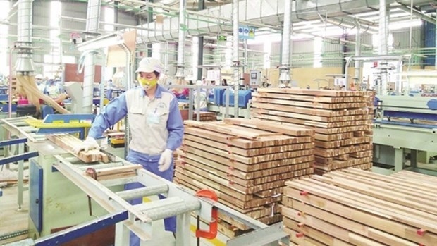
Plan on implementing Decision No. 327/QD-TTG dated March ...
Concretize viewpoints, objectives, tasks and solutions of the plan in accordance with practical conditions of the locality, associating ...Plan on implementing national environmental protection ...
Implementation plan of marine aquaculture development ...
Program on conservation and development of Vietnamese ...
Plan on improving quality of human resources to 2025 and ...

Efforts taken to turn culinary culture into national ...
The Vietnam Cuisine Culture Association (VCCA) is taking steps to implement a project to build and develop Vietnamese culinary culture ...Vietnamese cuisine making a name for itself with ...
Vietnam advance to next round of AFC U20 Women’s Asian Cup
Cultural tourism and traditional values promoted through ...
