


Construction plan of the Central Highlands to 2030
Wednesday, December 21,2016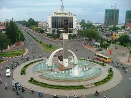
AsemconnectVietnam - The Central Highland has a special important strategic location for national security of the country.
CONSTRUCTION PLAN OF THE CENTRAL HIGHLANDS TO 2030
I. Content of plan
1. The Central Highland region includes five provinces: Kon Tum, Gia Lai, Dak Lak, Dak Nong and Lam Dong with total area of 54,641.069 km2.
2. Period of the plan: a short-term period to 2020, long-term period: 2020-2030.
3. Position of the region:
- The Central Highland has a special important strategic location for national security of the country.
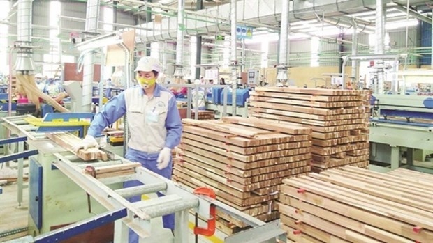
- Being a trade hub and transit of goods, service, tourism of the Mekong region countries and the East sea region; key region of development of key industrial crops of coffee, pepper, rubber and manufacturing high-tech vegetables for export; region of development of agro - forestry, hydropower - irrigation, mining and processing bauxite.
- Being a region of watershed protection, conservation and development of natural forest resources and protection of biodiversity of the country; buffer region of ecological safety and supplying water for coastal south central region, southeast region.
- Being a region of conservation of long-term cultural characterized identity of Central Highlands; developing humanity cultural tourism, ecological, landscape tourism, national and international resorts.
4. Development forecast of the region:
4.1. Population forecast
By 2020, population of the entire region is around 6,211,500 people, urban population is about 2,081,800 people, urbanization rate is about 33.5%; by 2030, population of the entire region is around 7,390,600 people, urban population is approximately 3,095,600 people, urbanization rate of about 40.7%.
4.2. Forecast of urban construction land
By 2020, urban construction land is about 23,888 ha, 110-120 m2/person on average; by 2030, about 33,475 ha, an average of 100 - 120 m2/person.
5. Region’s spatial development orientation:
5.1. Common development orientation
By 2030, urban system of the Central Highlands develops in each stages in accordance with adjustment orientation of master plan on development of Vietnam's urban system to 2025, vision to 2050; national urban development program in a period of 2012 - 2020; plan on construction of borderland of Vietnam - Laos to 2020 and master plan on socio-economic development of the Central Highlands to 2020 and in consistent with requirements of socio-economic development of each province and the whole region.
5.2. Spatial development orientation of the Central Highlands
To base on specific characteristics on nature, technical infrastructure, and field of professional development and key strategic development orientation of the country... the Central Highlands is divided into sub-regions and economic development corridors. Each economic subregion associates with development of dynamic urban of the region, urban centers of sub-region and small urban having functions of general service and trade.
5.3. North Central Highlands subregion
Including two provinces of Gia Lai and Kon Tum, focusing on developing hydropower industry; forming eco-tourism, tourism areas associating with national parks, nature conservation areas. Stabilizing development of industrial plants; promoting development of trade exchanges in border corridor of Vietnam - Laos - Cambodia.
5.4. Central subregion of Central Highlands
Including entire province of Dak Lak, focusing on development of industry of processing agro-forestry products, especially manufacturing, processing and exporting coffee.
5.5. South subregion of Central Highlands
2. Period of the plan: a short-term period to 2020, long-term period: 2020-2030.
3. Position of the region:
- The Central Highland has a special important strategic location for national security of the country.
- Being a trade hub and transit of goods, service, tourism of the Mekong region countries and the East sea region; key region of development of key industrial crops of coffee, pepper, rubber and manufacturing high-tech vegetables for export; region of development of agro - forestry, hydropower - irrigation, mining and processing bauxite.
- Being a region of watershed protection, conservation and development of natural forest resources and protection of biodiversity of the country; buffer region of ecological safety and supplying water for coastal south central region, southeast region.
- Being a region of conservation of long-term cultural characterized identity of Central Highlands; developing humanity cultural tourism, ecological, landscape tourism, national and international resorts.
4. Development forecast of the region:
4.1. Population forecast
By 2020, population of the entire region is around 6,211,500 people, urban population is about 2,081,800 people, urbanization rate is about 33.5%; by 2030, population of the entire region is around 7,390,600 people, urban population is approximately 3,095,600 people, urbanization rate of about 40.7%.
4.2. Forecast of urban construction land
By 2020, urban construction land is about 23,888 ha, 110-120 m2/person on average; by 2030, about 33,475 ha, an average of 100 - 120 m2/person.
5. Region’s spatial development orientation:
5.1. Common development orientation
By 2030, urban system of the Central Highlands develops in each stages in accordance with adjustment orientation of master plan on development of Vietnam's urban system to 2025, vision to 2050; national urban development program in a period of 2012 - 2020; plan on construction of borderland of Vietnam - Laos to 2020 and master plan on socio-economic development of the Central Highlands to 2020 and in consistent with requirements of socio-economic development of each province and the whole region.
5.2. Spatial development orientation of the Central Highlands
To base on specific characteristics on nature, technical infrastructure, and field of professional development and key strategic development orientation of the country... the Central Highlands is divided into sub-regions and economic development corridors. Each economic subregion associates with development of dynamic urban of the region, urban centers of sub-region and small urban having functions of general service and trade.
5.3. North Central Highlands subregion
Including two provinces of Gia Lai and Kon Tum, focusing on developing hydropower industry; forming eco-tourism, tourism areas associating with national parks, nature conservation areas. Stabilizing development of industrial plants; promoting development of trade exchanges in border corridor of Vietnam - Laos - Cambodia.
5.4. Central subregion of Central Highlands
Including entire province of Dak Lak, focusing on development of industry of processing agro-forestry products, especially manufacturing, processing and exporting coffee.
5.5. South subregion of Central Highlands
Including two provinces of Dak Nong and Lam Dong, focusing on developing service sector, tourism resorts; industry of mining, processing mineral and high-tech agriculture.
5.6. Corridors of urban-economic development
- Economic corridor on the east: Including districts locating on the east of provinces of Kontum, Gia Lai, Dak Lak, being a zone of development of agriculture and forestry. In plain terrain areas, developing paddy, sugar cane; in high mountains area, maintaining and developing forest, conservating biodiversity; constructing industrial clusters of processing of agricultural - forestry products associating with material plant area; developing eco-tourism zones, resorts and cultural - historical tourism associating with scenic, historic sites.
- Economic corridor in the central (including Kon Tum, highland, Pleiku, Dak Lak): locating alongside Ho Chi Minh road. Focusing on developing key industrial crops for export (coffee, rubber, cashew, pepper ...) developing fruit trees for domestic market; food crops and livestock breeding. Developing large, small and medium-sized urban area; large industrial parks, clusters associating with urban areas and raw materials, inter-regional transport hub. Developing trade and service centers, center of transit of goods, tourism, education, health, culture, sports.
- West economic corridor: Including entire western region of districts of Dak Glay, Ngoc Hoi, Sa Thay (Kon Tum province), Ia Grai, Duc Co, Chu Prong (Gia Lai province), Ea Sup, Buon Don, Cu Jut (Dak Lak province) and entire province of Dak Nong. Focusing on development of industry of mining and processing bauxite, alumina refining and hydropower energy; in areas alongside border, forming small and medium-sized economic defense zone associating with systems of border gate and border markets. In area of high mountain, developing forest to protect natural ecosystems, water resources, special use forests, watershed forests.
- Urban - economy zone in south Central Highlands (Lam Dong province): Including entire province of Lam Dong. Focusing on growing high-tech vegetable, flowers for export and domestic market; growing tea, mulberry, cotton, coffee, fruit; developing eco-tourism, resort, conference, workshops, cultural festivals. Conservating biodiversity, watershed protection, Dong Nai river system; national and international major tourist centers in city of Da Lat; multidisciplinary training centers; national centers of nuclear and biology research.
- To develop large industrial parks and clusters associating with urban area of Lien Nghia - Lien Khuong, Bao Loc and inter-regional traffic hub, raw material region. Focus on industries of production of agro - forestry, bauxite mining, aluminum, paper production, construction materials, pharmaceutical, fertilizer, textiles, garments, sweets, alcohol, mechanical, furniture; handicraft - traditional crafts (knitting, weaving, cooking wine, fruit processing...). Constructing service center of transshipment (logistic) in major urban areas, transport hub (urban areas of Lien Khuong, Bao Loc city); areas of development of important hydropower projects.
6. Orientation of using land:
- To maintain, develop and protect forest resources and ecological environment; prioritizing land for socio-economic infrastructure development of region and the country, land for agricultural production associating with water resource and climate conditions, land for national defense and security purpose and preserving cultural ethnic identity.
- Forecasting demand for use of land by 2030: urban construction land is about 33,470 ha; construction of rural residential areas of about 68,720 ha; land of construction of industrial parks and clusters is about 11,880 ha; approximately 4,035,320 hectares of agricultural land; area of forest land is about 3,336,000 ha; land of infrastructure construction is about 3,690 ha.
7. Development orientation of urban systems and rural residential areas:
7.1. Network of urban systems
Urban network in the Central Highlands is divided as follows: urban centers of the Central Highlands, central urban areas of provinces and subregions and small urban centers of districts and specialized service urban area. Specifically: Ban Me Thuot city is a center of the Central Highlands; Da Lat city is a national center of tourism and regional specialized centers of the Central Highlands; cities of Pleiku and Kon Tum, Gia Nghia are regional synthesis centers and specialized centers of provinces; urban areas of Ngoc Hoi (Pleikan), Mang Den - Kon Plong, Buon Ho, An Khe, Kien Duc, Eaka, Duc Lap (Dak Mil), Bao Loc are urban centers of sub-regions; international economic border gate zone of Bo Y, economic border gate zone of Le Thanh are dynamic urban in border areas; central towns of districts plays a role of synthesis service urban to promote socio-economic development of the entire district.
7.2. Distribution of urban system
By 2020, the Central Highlands has 89 cities on basis of upgrading and expanding existing 62 urban areas and forming newly 27 new urban areas, including 03 urbans of grade I, 02 urbans of grade II, 03 urban of grade III, 15 urbans of grade IV, 66 urbans of grade V.
By 2030, the Central Highlands has 117 urban areas on basis of upgrading 89 existing urban areas and newly building 28 urban areas, including 03 urban areas of grade I, 03 urban areas of grade II, 07 urban area of grade III, 21 urban areas of grade IV, 83 urban areas of grade V.
7.3. Development orientation of rural residential areas
System of rural residential areas are arranged on basis of existing residential areas and residential arrangement plan oriented under orientation of production organization and economic development of the wholly region; ensuring to minimize impact of natural disasters and climate change; being convenient in transport connection with communal roads, inter-district roads and inter-regional roads; being in line with traditional cultural practices, production and people’s living activities to meet requirements of production and living of the people under new rural criteria.
8. Orientation of socio - economic infrastructure development:
8.1. Orientation of service-trade development
In large urban areas: Buon Ma Thuot, Da Lat, Pleiku, Gia Nghia, Kon Tum, Bao Loc: building modern service facilities include a business center, supermarkets, shopping centers, zones of trade - services, wholesale depots, fair - exhibition centers...; system of distribution, product warranty agents; center of transshipment service (logistic)...
In sub-regional urban centers such as Buon Ho, Ayunpa, An Khe, Chu Se, Ngoc Hoi (Pleikan), Dak To, Lien Nghia - Lien Khuong, Phuoc An, Kien Duc and other urban areas grade IV: building supermarkets, shopping centers, trade-service zones, wholesale depot, subregional wholesale markets...
In townships, urban areas grade V: building central market, supermarket, convenience store, retail stores, stations of purchasing agricultural products; purchasing agent. Constructing markets for people mountainous areas, remote area; central market, specialized markets, wholesale markets...
8.2. Development orientation of border gate and economic zone system
By 2030, building 10 border gates, including 04 international border gates: Bo Y (Kon Tum province), Le Thanh (Gia Lai province), Bu Prang (Dak Nong province), Dak Rue (Dak Lak province); 01 national border gate of Dak Per (Dak Nong province); 05 border gates of Ta Bop, Ta Dat, Mo Rai, Ho Le (Kon Tum province), Sa Thay (Gia Lai province). Constructing pairs of border markets for the people in bordering areas.
To promote development of Bo Y international border gate economic zone and Le Thanh international border gate economic zone, which represent a role as driving force of socio-economic development of the Central Highlands and triangle development of Vietnam - Laos - Cambodia.
8.3. Development orientation of health facilities
To construct two regional major medical centers in cities of Buon Ma Thuot and Da Lat. In Dalat city, building international health care centers, combining with serving tourists.
In urban center of the province: Constructing provincial general hospitals and a network of health centers to serve the people.
To renovate and construct specialized hospitals in provinces. Establishing high tech medical diagnostic center, nuclear medicine and radiation therapy center of the Central Highlands in province of Lam Dong.
In each district, building 01 district general hospitals, 01 preventive health center. Strengthening health network of communes and villages. Upgrading and expanding communal health stations in both facilities, equipment and medical staff.
8.4. Development of education and training facilities
By 2030, striving that 100% of districts, towns have vocational education center which operates effectively, 90% of communes have community learning centers.
To build 02 regional major training centers in cities of Buon Ma Thuot, Da Lat; expanding scale of universities and colleges; the region will has 15 universities and colleges, including 5 universities, 10 colleges.
8.5. Development orientation of sport - culture
To preserve and restore typical historic, cultural relics associating with education and tourism development. Maintaining and building public spaces in villages for community cultural activities associating with hollow, gong festivals.
To upgrade colleges of arts and culture. Establishing Central Highland university of art and culture in Dak Lak province; constructing cultural center of Dak Nong province, building conference center of the Central Highland, the Central Highland ethnic museums in city of Ban Me Thuot.
To build Central Highlands sport complex in city of Buon Ma Thuot (Dak Lak province), which is a major sports center, playing a role as regional center and national sport training center in city of Da Lat
To maintain football academy of Hoang Anh - Arsenal in Pleiku city and regional sport talent school in Dak Lak and Gia Lai provinces.
To construct provincial sports center locating in provincial towns to meet requirements of athletes training, organizing physical sport activities of localities and supporting sports competitions at national level.
Subregional sports center in townships with a scale of 6-7 ha; sport centers in communes with a scale of 1.5 - 3 ha and in each village, building a sport field.
8.6. Development orientation of tourism
To develop key tourism projects to form national and regional tourism zones, creating tourism trademarks for the Central Highlands and Vietnam. Associating development of tourism with environment protection, promoting value of traditional culture. Promoting tourism links between the Central Highlands with other provinces in the Central and southeast region.
To construct major tourism centers of region in cities of Buon Ma Thuot, Pleiku, Da Lat associating with national tourism zones, national tourism sites and tourism urban of Dalat.
To construct other tourism service centers in cities, towns and single tourism service point associating with natural landscapes, villages of ethnic culture and hydropower reservoirs.
8.7. Development orientation of industrial parks, industrial clusters
By 2030, constructing 24 industrial parks and 74 industrial clusters, including fields: industry of processing agro forestry, energy, hydropower production, production of construction materials, mining industry, microbial fertilizer production, production of consuming goods, textiles, garments, footwear, mechanical, production of processing equipment, transportation equipment, agricultural machinery, agricultural machinery assembling. Key industrial parks including: Hoa Binh, Sao Mai, Bo Y, Tra Da, Tay Pleiku, Hoa Phu, Ea H'leo, Tam Thang, Quang Duc, Loc Son, Phu Hoi, Dai Lao, Tan Phu, Le Thanh international border gate and processing of bauxite in provinces of Dak Nong, Gia Lai and Lam Dong.
In each district, forming 1-2 industrial clusters with scale of 20-50 hectares, focusing on industry of processing agro - forest products for local economic development.
To develop handicraft industrial clusters and traditional villages associating with development of agriculture and forestry production, service sectors in rural areas.
9. Development orientation of agricultural and forestry areas:
9.1. Orientation of agricultural development
To associate area of development of agricultural production with development of rural residential area. Minimizing conversion of agricultural land to other purposes; expanding area of rubber cultivation in border area, combining economic development with protection of national security, greening barren land. Reducing coffee growing area of low productivity to reduce groundwater extraction. Strengthening infrastructure, processing facilities, applying science and technology to serve agriculture and forestry.
9.2. Development orientation of forestry
To protect existing forest area, replanting synthesis forests by industrial material forest which have economic value to increase forest coverage to 61%.
To improve system of special-use forests, nature reserves, national parks with planned scale to conserve biodiversity, protect rare genetic resources, landscape and value of scientific - cultural - historical as well as developing tourism, relaxation tours, ecotourism.
To develop protective forest system with a suitable scale to meet requirements of protection of watershed, border and coastal urban areas, industrial parks to create windbreak forest belt, flood prevention, soil erosion control, regulate adverse effects of nature.
To grow timber forests, forest of raw materials in districts of Dak To, Ngoc Hoi - Kon Tum; provinces of Gia Lai, Dak Lak.
To maintain and evenly distributed primitive forests, plantation forest in provinces, especially in western region nearing Vietnam - Cambodia border and eastern areas bordering the Central coast region.
10. Development orientation of technical infrastructure
10.1. Development orientation of transport
- Inter regional transport
In a period to 2030: gradually building, completing and fundamentally modernizing infrastructure networks of road, railway, inland waterways and airway under national plan of transportation development and the Central Highlands.
To upgrade and complete highway No.29 toward highway standards; upgrading provincial road No.721 (Lam Dong province), connecting with to provincial road No.713 (Binh Thuan province), establishing a new highway linking Ho Chi Minh road with national road No.1A through provinces of Binh Phuoc - Lam Dong - Binh Thuan.
- Urban transport: Proportion of transport land to urban areas must ensure rate of 23-25% in urban area grade I; 21-23% in urban area grade II and 18-20% in urban area grade III; 16-18% in urban area grade IV and V.
- Rural transport: giving priority to build auto roads to all centers of commune, ensuring 100% of district roads, communal roads to be used in rainy season; reaching road standard of level IV - V.
- Bus stations: Constructing completely, at right technical level to ensure that each district has at least a bus station in center of district.
10.2. Orientation of technical preparation
- Choosing construction land: Using inefficient land of agriculture, forestry, hilly areas, fallow land to develop urban areas and industrial parks. Do not building urban areas, residential areas and industrial parks in areas of high risk of natural disasters, neighborhood areas of mineral mining...
- Orientation of drainage:
By 2030, urban areas in the region reach 80-100% of culvert under roads. Developing synchronously, completely drainage system for urban areas grade I, II and III, towards entire urban areas and concentrated residential areas will be built drainage system in a period to 2020.
- Measures of preventing natural disasters, geological disasters:
To construct embankment of preventing erosion; building reservoirs, irrigation and hydropower in upstream areas, strengthening regulatory role of surface water, flood control, irrigation and power supply.
To strengthen management and watershed reforestation; constructing monitoring stations on main river basins. Reviewing residential areas affected frequently by natural disasters to gradually implement project of displacing residents to safety areas, having plan of proactive evacuation if necessary.
10.3. Orientation of water supply
Water supply standard: by 2020, ensuring that 80%, 100% and by 2030: 90 ¸ 100% of urban resident can access to clean water with a standard of 100¸150 liters/person/day and night; standards of rural water supply of 80¸150 liters/ person/day and night, supplying hygienic water to 80-90% of population.
- Total demand on water supply in the wholly region in 2020: 660 200 m3/day and night, by 2030: 1,142,300 m3/day and night. Total demand of industrial water in the wholly region: 222 600 m3/day and night.
- Water resource: primarily using surface water, groundwater is source of additional water for urban area which are difficulty in surface water resource.
10.4. Orientation of power supply
Total demand on electricity of the region is approximately 490 MW by 2020, 1510 MW by 2030.
By 2030, building 6 huge hydropower plants. The wholly region will have 22 hydroelectric power plants connecting to 220 kV and 500 kV transmission line with a total capacity of 4.540 MW.
System of electricity stations and transmission lines of 500 kV, 220 kV must comply power plan VII. System of electricity station and below 110 kV lines will be developed under power development plan of each province.
Provinces in the region should study construction of small and medium-sized hydropower projects in order to avoid negative impacts on natural environment and society.
10.5. Orientation of sewerage, solid waste management and cemetery
- Waste water drainage:
Total demand on water drainage and living wastewater treatment of the wholly region to 2020 is approximately 494,000 m3/day and night and 687,530 m3/day and night by 2030. Total amount of industrial waste water, which are needed to be treated, is 220,770 m3/day and night.
To plan separate drainage system with concentrated wastewater treatment stations in big cities. Planning common sewerage system in early stages and separate sewerage system in long-term period, using biological lakes for wastewater treatment in other townships in the region.
To plan separate sewerage systems for industrial parks and economic zones of provinces.
Rural residential areas: planning common sewerage system. Wastewater is treated through septic tanks and ensures sanitation.
- Collection and treatment of solid waste:
Total amount of living solid waste of the wholly region is 2,968 tons/day by 2020 and 3,840 tons/day by 2030. Planning 01 inter-provincial solid waste treatment ground in Cu Ebur commune, Buon Ma Thuot city (with an area of 150-200 ha); planning 24 solid waste treatment grounds (total area of 1,120 ha).
In township, communes, arranging sanitary solid waste treatment grounds.
- Orientation of planning cemetery:
Total area of cemetery in the wholly region is 370 ha by 2020 and 450 ha by 2030. Provincial and regional cemetery use modern burial technology (as cremation), ensuring regulations on environmental protection.
Each city, town, township will plans separate cemetery. In rural areas, each village plan a concentrated cemetery.
10.6. Orientation of environment protection
- Forest protection: strengthening management, protection and development of forests, strictly protecting national parks, nature conservation areas (Chu Mom Ray, Kon Cha Rang, Kon Ka Kinh, Yok Don, Chu Yang Sin, Ta Dung, Cat Tien, Bidoup ...).
- Hydropower: projects of hydropower development on Se San river system (Gia Lai - Kon Tum province); Ba river system (Gia Lai province); Serepok river system (Dak Lak province) and Dong Nai river system (Dak Nong and Lam Dong province) must ensure to reduce maximum environmental risks and impacts on society, natural ecosystems and biodiversity.
- Mineral mining: Mineral mining in the region such as peat, lignite, kaolin clay ... especially bauxite in Dak Nong and Lam Dong province must ensure to does not affect environment. Giving priority to invest advanced mining technology with high efficient of ore recovery.
- Protection of water resources: constructing, renovating and upgrading of irrigation works (mainly water reservoir); restoring and developing forests, vegetation ... to protect surface of soil surface.
- Protecting environment in urban areas, industrial facilities and tourism centers: giving priority to build completely system of technical infrastructure (constructing wastewater treatment systems, collection and treatment of solid waste).
- To reduce risks, natural disasters and environmental incidents: managing and developing watershed reforestation to combat erosion and floods, improving barren soil, increasing watershed protection forest coverage in major river basins.
11. Program and projects given priority to investment by 2020:
- To continue to invest in upgrading key transport network in direction of north - south and east – west, building border corridor road, upgrading national road No.24 of section of Kon Tum - Quang Ngai; upgrading national road No. 19 of section of Gia Lai - Binh Dinh; upgrade provincial road linking national borders; upgrading and building new border patrol roads; boundary road; upgrading and expanding port of Lien Khuong, Buon Ma Thuot, Pleiku to hit international standards on domestic airports.
To invest in building key economic units, infrastructure of economic zones: Bo Y international border gate, Le Thanh international border gate; urban areas; industrial parks, industrial clusters in region.
To construct tourism zones of Mang Den - Kon Plong, Tuyen Lam lake; Dan Kia - Suoi Vang, tourism cultural zone of Langbian, national park of Biduop - Nui Ba; ecotourism zone of Buon Don, eco-tourism zone associating with national park, nature reservation zone, hydropower – irrigation reservoirs, historic relics, huge landscapes.
To expand university of Central Highlands; building political academy in the Central Highlands (under Ho Chi Minh national political academy); building university of transportation in the Central Highlands; upgrading Dak Lak university of art and culture; university of practice technology in the Central Highlands.
To upgrade general hospitals of provinces; building traditional medicine hospital of Kon Tum province; tuberculosis and lung disease hospital of Gia Lai and Kon Tum provinces; building a children's hospital, maternity hospital and upgrading, expanding hospital of nursing and rehabilitation in Lam Dong province.
12. Suggesting mechanism and policies of regional development:
Provinces promulgates proactively control policies and cooperation mechanisms to promote regional development, controlling population distribution in the wholly region, controlling formation and development of urban areas, economic zones, industrial parks, tourism services zones... to ensure compliance with approved plans; land control policies, policies of control of construction investment; investment preferential policies for each specific area to facilitate construction of technical, social and services infrastructure; policies of capital mobilization and allocation, having special programs to attract investment capital sources from domestic and foreign organizations and individuals.
To promote cooperation among localities in the Central Highlands, building key regional technical infrastructure (sewage treatment works, water supply source...)
II. Organizing implementation
- Ministry of Construction organizes to make public construction plan of the Central Highlands to 2030; organizing implementation of plan in accordance with provisions of current law.
- People's Committees of provinces in the region review, adjust or implement provincial construction plans and other plans according to contents of approved construction plan of the Central Highlands to 2030.
L.Giang
Source: moj.gov.vn
Scheme on attracting, restructuring and improving quality of labor resources in Binh Phuoc province in a period of 2021 - 2025, orientation to 2030
Plan on implementing national strategy on climate change for a period to 2050 in Quang Binh province
Plan on improving quality of human resources to 2025 and orientation to 2030
Program on conservation and development of Vietnamese craft villages in a period of 2021 - 2030
Implementation plan of marine aquaculture development project in Ninh Binh province to 2030 with a vision to 2045
Plan on implementing national environmental protection strategy to 2030 with a vision to 2050 in Kien Giang province
Plan on implementing Decision No. 327/QD-TTG dated March 10, 2022 of the Prime Minister approving the project on developing sustainable and effective wood processing industry in the period of 2021-2030 in Gia Lai province
Action plan on implementing strategy of sustainable agricultural and rural development in a period of 2022-2030 with a vision to 2050 in Hanoi city
Plan on implementing Decision No.923/QD-TTG dated August 2, 2022 of the Prime Minister approving science and technology program for new rural construction in a period of 2021-2025 in Vinh Long province
Plan on implementing strategy of sustainable agricultural and rural development in Bac Kan province in a period of 2021 - 2030 with a vision to 2050
Action plan on implementing livestock development strategy in a period of 2022-2030 with a vision to 2045 in Hanoi city
Implementation plan of Vietnam's forestry development strategy for a period of 2021-2030 with a vision to 2050 in Gia Lai province
National master plan in a period of 2021-2030, vision to 2050
Program on strengthening environmental protection, food safety and rural clean water supply in building new countryside in a period of 2021-2025
Plan on implementing Decision No. 327/QD-TTG dated March ...
Concretize viewpoints, objectives, tasks and solutions of the plan in accordance with practical conditions of the locality, associating ...Plan on implementing national environmental protection ...
Implementation plan of marine aquaculture development ...
Program on conservation and development of Vietnamese ...
Plan on improving quality of human resources to 2025 and ...

Efforts taken to turn culinary culture into national ...
The Vietnam Cuisine Culture Association (VCCA) is taking steps to implement a project to build and develop Vietnamese culinary culture ...Vietnamese cuisine making a name for itself with ...
Vietnam advance to next round of AFC U20 Women’s Asian Cup
Cultural tourism and traditional values promoted through ...
