


Adjusted master plan of Nam Dinh city till 2040 with a vision till 2050
Tuesday, April 30,2019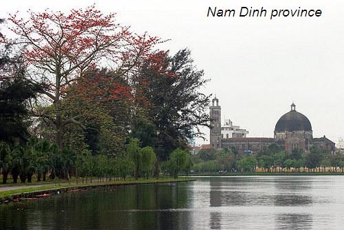
AsemconnectVietnam - Adjusting the general planning of Nam Dinh city with new development positions and trends, in the context of international integration and globalization, effectively exploiting the city's development potentials towards sustainable and strong development.
1. Scope, boundaries and scale of planning
a) Maintaining the planning scope and boundaries in Decision No. 2084 / QD-TTg of November 22, 2011, specifically: The entire administrative boundary of Nam Dinh city; My Loc district; communes of Dai An, Thanh Loi and Tan Thanh of Vu Ban district and communes of Nam My, Nam Toan, Hong Quang, Dien Xa and Nghia An of Nam Truc district.
Limit:
- North: adjacent to Ha Nam province.
- The West borders the rest of Vu Ban district.
- The South borders the rest of Vu Ban and Nam Truc districts.
- The East borders Thai Binh province.
b) Planning scale: about 18,799 ha.
2. Planning period
- Short-term period to 2030.
- Long-term period until 2040.
3. Goals
Adjusting the general planning of Nam Dinh city with new development positions and trends, in the context of international integration and globalization, effectively exploiting the city's development potentials towards sustainable and strong development.
Building Nam Dinh into a civilized and environmentally friendly city with a synchronous and modern socio-economic infrastructure system to prevent natural disasters and cope with climate change.
Nam Dinh development is associated with outstanding potentials in historical, educational, industrial and service cultures.
As a basis for urban management and development. Create favorable opportunities for development programs, investment projects, and soon bring Nam Dinh into a central city of the Region.
4. Nature
- Being a provincial town, a political, economic, cultural, social, scientific and technical and educational center of Nam Dinh province.
- Being an economic, cultural, scientific and training center and tourist health service center of the Southern Red River delta. Being an urban area with outstanding cultural and historical values.
- Being an area with an important position on defense and security.
5. Forecast of preliminary development
About population growth forecast
- Population by 2030: about 520,000 - 547,000 people.
- Forecast by 2040 is about 600,000 - 621,000 people.
(Forecasting the size of land and population will be specified in the process of research and planning adjustment. Economic and technical standards shall comply with the standards of grade-I urban centers. Appropriate international standards and regulations).
6. Key requirements for research
- Review the content of the general plan approved in 2011 and compare and review the situation of urban development practice in Nam Dinh city. Researching orientations from higher level planning and new changes in socio-economic development of the country, region and province to find the issues to be adjusted in this master plan.
- Forecast of development needs in the new period, in the new development context. Develop new vision and strategies to develop the city from now until 2040 and vision to 2050 in a sustainable way.
- Proposing adjustments on urban structure, functional zoning, urban centers arrangement, land use planning, planning of technical infrastructure systems, environmental protection solutions, climate change response. Proposing solutions on urban design and urban management according to planning.
Develop programs and strategic projects that prioritize investment. Programs and projects that are highly feasible, flexible and responsive to immediate needs of development as well as long-term stability are driving forces to boost the city's economic growth.
7. The main requirements for the content of planning documents
a) Analysis of position and context of regional development
Analyzing the role and position of Nam Dinh city in relation to the Province, Red River Delta, Northern Coastal Region and Country. Evaluate the potentials and motivations for development, key sectors and economic sectors of the city.
Focus deeply on the potentials and strengths of Nam Dinh in the Region in the fields of historical culture, education and training, industry and services to serve as a premise for city development to 2040 visions to 2050.
b) Assess the status quo
- Analyzing and evaluating the natural characteristics of topography, climate, hydrology, geology ..., characteristics of ecological landscapes, natural resources, cultural and tourist resources of Nam Dinh city and other The surrounding area affects the development orientation of Nam Dinh city. Assessment of construction land fund based on favorable, unfavorable construction zones and construction prohibition.
- Assessing the situation of socio-economic development: Current situation of development of major industries and fields: tourism, trade, service, industry, small industries and handicrafts ... Current situation of population and labor dynamic work.
- Assessment of the current state of land use and landscape space: Statistics of the current state of land use in the planning area; analyze and evaluate the effectiveness of land use and the problems of land use, the space landscape to be addressed to meet development requirements.
- Evaluate the current status of technical and environmental infrastructure systems. Determining outstanding problems of urban technical infrastructure systems to meet grade-I urban standards.
- Review relevant programs, projects and projects and the implementation of the General Plan in 2011 up to now.
- Assessing the current situation, proposing key contents to be adjusted in the new planning.
c) Forecasting and proposing development models
Forecast for development to 2040 and determine the vision of Nam Dinh city until 2050 based on the potential and specific strengths. Identify relevant economic and technical indicators.
d) Space development orientation, functional subdivision, land use, landscape architecture and urban design:
- Select an adjustment plan on urban structure to ensure maximum exploitation of natural conditions, land and infrastructure. Note to exploit elements of natural landscape, water surface (Song Dao, Red River, Vinh Giang River) to exploit in urban space.
- Determining the scope and scale of functional areas of urban areas to be adjusted. Adjust and redistribute residential units; system of urban centers; system of green parks and sports; industrial zones, industrial complexes, warehouses, yards ... and other functional areas.
- Proposing to adjust urban centers and functional areas to be suitable with the current situation and investment and development needs of the city to ensure feasibility when deploying.
- Urban design:
Identify architectural areas, landscapes, central areas, urban gateway areas, main space axes, large squares, green space - water surface, urban highlights and propose raw rules, requires the organization of space and architecture for existing urban areas and expansion areas.
- Identify solutions to effectively conserve and promote urban spaces with historical and cultural values such as existing historical urban areas, clusters and populations of cultural - historical relics. Special values of provinces and countries.
- Land use planning in stages
Determining functions of land use for areas; determine criteria of population density, land use criteria; development orientations and principles for each functional area; propose land use plan in accordance with each development stage; identify the land fund planned to build urban development, urban development boundaries and urban areas.
d) Planning of technical infrastructure system
- Technical preparation: Proposing reasonable solutions for ground leveling and surface water drainage for urban areas and other construction areas; ensuring safety of floods and flooding; prevention of natural disasters ... in response to climate change. Proposing anti-erosion protection solutions. Zoning areas where construction is banned or restricted due to geological, topographical and natural disasters.
- Traffic: Organizing traffic network including external traffic, urban traffic and waterway traffic, provincial traffic system in urban development, classification of urban traffic routes and Design solutions for internal transport networks. Proposing networks and works to support the development of public transport activities in urban areas as well as connecting with other cities and surrounding areas. Determining the size and number of traffic focal works. Note the solutions for provincial traffic and public transport to meet the requirements of grade I.
- Water supply: Analyzing and evaluating water resources, proposing solutions for water supply and water source protection. Determining standards and demands for water use in production and daily life, expected supply sources, key works, water supply pipeline networks, fire-fighting water supply and technical parameters.
- Electricity and lighting: Determining standards and demand for electricity use; power balance options; propose solutions to design the power supply network, expected key works for each planning period. Calculate demand and propose solutions for smart lighting. Proposing to exploit and use other energy sources (if any).
- Communication: Orient the planning of passive telecommunications infrastructure system, anticipate key works according to each planning stage and synchronous optical transmission network in the direction of using lower facilities. floors and expansion of public telecommunications systems to meet the needs of use and serve socio-economic development and urban development under the model of smart urban.
- Waste water drainage, solid waste treatment and cemetery collection: Determining standards and forecasting volumes of waste water and solid waste discharge, cemetery land demand. Orientation of wastewater collection and solid waste treatment system; cemeteries and funeral homes in urban areas.
- Forecast and propose solutions to prevent, minimize and overcome natural disasters, based on the latest national climate change and sea level rise scenarios and specific studies for Nam Dinh city.
- Forecasting environmental impacts from residential urban development activities, agricultural, forestry and aquaculture production, transportation, industry, mining, ports ... Proposing solutions solutions to solve environmental problems still exist in planning projects. Identify measures to prevent, minimize impacts and manage and supervise the environment, ensure sustainable development.
g) Determining investment priority programs and projects to ensure compliance with the forecasted resources for implementation.
h) Draft Regulation on management according to planning adjustment scheme.
8. Product profile:
The composition of the dossier and the contents of the project comply with the Government's Decree No. 37/2010 / ND-CP of April 7, 2010, on appraisal, approval and management of urban planning and legal regulations. Current law.
9. Organization of implementation
- Approval level: Prime Minister.
- Appraisal agency: Ministry of Construction.
- The submission agency: Nam Dinh People's Committee.
- Planning organization: Nam Dinh Department of Construction.
- Time for completion: Not exceeding 12 months from the date of approved planning tasks.
- Nam Dinh People's Committee allocates capital and approves the total cost estimate for planning; coordinate with the Ministry of Construction and related ministries and branches to organize and submit for approval the general planning adjustment plan of Nam Dinh city up to 2040, vision to 2050 according to the law.
Long Giang
Program on conservation and development of Vietnamese craft villages in a period of 2021 - 2030
Implementation plan of marine aquaculture development project in Ninh Binh province to 2030 with a vision to 2045
Plan on implementing national environmental protection strategy to 2030 with a vision to 2050 in Kien Giang province
Plan on implementing Decision No. 327/QD-TTG dated March 10, 2022 of the Prime Minister approving the project on developing sustainable and effective wood processing industry in the period of 2021-2030 in Gia Lai province
Action plan on implementing strategy of sustainable agricultural and rural development in a period of 2022-2030 with a vision to 2050 in Hanoi city
Plan on implementing Decision No.923/QD-TTG dated August 2, 2022 of the Prime Minister approving science and technology program for new rural construction in a period of 2021-2025 in Vinh Long province
Plan on implementing strategy of sustainable agricultural and rural development in Bac Kan province in a period of 2021 - 2030 with a vision to 2050
Action plan on implementing livestock development strategy in a period of 2022-2030 with a vision to 2045 in Hanoi city
Implementation plan of Vietnam's forestry development strategy for a period of 2021-2030 with a vision to 2050 in Gia Lai province
National master plan in a period of 2021-2030, vision to 2050
Program on strengthening environmental protection, food safety and rural clean water supply in building new countryside in a period of 2021-2025
Digital transformation program on building new countryside, towards smart new countryside in a period of 2021 - 2025
Rural tourism development program on new rural construction in a period of 2021 - 2025
Project on development of trade, e-commerce systems and border trade in Binh Phuoc province in a period of 2021-2025, orientation to 2030
Plan on implementing Decision No. 327/QD-TTG dated March ...
Concretize viewpoints, objectives, tasks and solutions of the plan in accordance with practical conditions of the locality, associating ...Plan on implementing national environmental protection ...
Implementation plan of marine aquaculture development ...
Program on conservation and development of Vietnamese ...
Plan on improving quality of human resources to 2025 and ...

Efforts taken to turn culinary culture into national ...
The Vietnam Cuisine Culture Association (VCCA) is taking steps to implement a project to build and develop Vietnamese culinary culture ...Vietnamese cuisine making a name for itself with ...
Vietnam advance to next round of AFC U20 Women’s Asian Cup
Cultural tourism and traditional values promoted through ...
